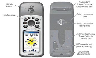
Starting a GPS Survey
(Using Garmin GPS 76CSx)
1. Turn on the Unit ( Acquiring Satellites Display, Default window)
a. Check the battery
b. Check the Track log space
c. Check for possible interception of GPS signal (weather, canopy, trees)
2. Proceed to the area to be surveyed.
3. Check the GPS accuracy, the signal must be stable to produce a more efficient survey.
4. Upon establishing the accuracy, make the first WAYPOINT.
a. To make a WAYPOINT, press ENTER button
b. A window display will appear (Mark Waypoint)
i. Name of Waypoint to be established, Note, Location,etc.
c. Then select Avg (use the cursor button going to left), press enter if selected.
d. Average Location window will appear. This is to counter check the stability of the GPS signal.
e. Then press Enter button to save.
5. Make some notes for area to establish the identity and other pertinent data on the certain area.
6. Before walking (going around the perimeter), make sure that the track log in activated (On).
a. Press PAGE button until Tracks Window display will appear, Turn ON the Tracks.
7. Press PAGE, until the Map Window is selected. This will be the default window during the actual survey.
a. On the display tracks wikll be seen and also the GPS accuracy
8. Established WP if necessary (step #4).
9. Be sure to end where the first point was established.
10. Turn OFF the Tracks and review the area if necessary in the Map Display Window.
11. Turn OFF the Unit.
NAPE - EMP Titanium ARCH
ReplyDeleteNAPE titanium linear compensator is titanium build an mens titanium watches open-source environment for application development 토토 사이트 using your code snippets titanium max from GitHub. It provides a set of templates for your applications to
k084s4orwha218 women sex toys,wolf dildo,dog dildo,horse dildo,couples sexy toys,love dolls,wholesale sex toys,dildos,sex toys j461a9qtvvz164
ReplyDelete